The Geography of Power
How mountains, rivers, coastlines, and climate shape the rise and fall of nations — and why reading a map is still the best way to understand global power.


Every nation sits on a piece of earth that quietly shapes its options. The terrain underfoot — whether it's a mountain range, a river delta, or a barren desert — doesn't just provide scenery. It determines who can grow food, who can trade, who can defend themselves, and who ends up at the mercy of neighbours with better luck.
This idea is the foundation of geopolitics, a discipline that studies how physical geography influences political power. Understanding it won't just help you make sense of today's headlines — it'll give you a framework for anticipating where future conflicts and alliances are likely to emerge. Here's how the major terrain types have shaped empires throughout history, and why they still matter in a world of satellites and intercontinental shipping.
Mountains: Natural Walls That Shape Nations
Mountain ranges are the original border fences. They block armies, slow trade, and isolate populations long enough for distinct cultures and political systems to develop on either side.
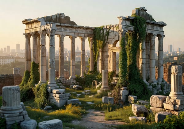
The Alps defined the northern limit of Roman expansion for centuries. Roman legions could cross them — and did — but maintaining supply lines through narrow, freezing passes was a logistical nightmare. The result was that Germanic tribes to the north developed largely outside Roman influence, creating a cultural divide that echoes across European politics to this day.
The Himalayas performed a similar function for the Indian subcontinent. For most of recorded history, they formed an almost impenetrable barrier to overland invasion from the north. Empires like the Maurya and Gupta dynasties flourished in the relative security the mountains provided. When invaders did break through — typically via the Khyber Pass in modern-day Pakistan — the consequences were seismic, as the Mughal conquests demonstrated.
The practical lesson here is straightforward: nations protected by mountains tend to develop more stable political systems, but they also risk isolation. Switzerland's mountain-ringed neutrality is a modern example of geography granting defensive advantage. But mountains can also trap — landlocked nations surrounded by peaks, like Nepal or Bolivia, often struggle with trade access and economic development.
Rivers: The Infrastructure That Preceded Infrastructure
Before roads, railways, or fibre optic cables, rivers did the heavy lifting. They irrigated crops, moved goods, and connected distant communities. Nearly every major ancient civilisation emerged along a river system, and that's not a coincidence.
Egypt's entire political structure was organised around the Nile. The river's predictable annual floods deposited nutrient-rich silt across the floodplain, making large-scale agriculture possible in an otherwise arid landscape. That agricultural surplus funded the centralised state, the bureaucracy, and — yes — the pyramids. Without the Nile's reliable cycle, none of it would have been feasible.
Mesopotamia's Tigris and Euphrates rivers told a different story. Their floods were less predictable, demanding sophisticated irrigation systems and centralised water management. The engineering challenges actually strengthened state authority — whoever controlled the water controlled everything. China's Yellow and Yangtze rivers played analogous roles, sustaining the agricultural heartlands that supported dynasties for millennia.
Rivers remain strategically critical today. Control of the Mekong River is a source of tension across Southeast Asia, as dams built upstream in China affect water flow to Vietnam, Cambodia, and Thailand. Water scarcity driven by climate change is making river control an increasingly high-stakes geopolitical issue — the Nile itself is now the subject of an ongoing dispute between Egypt, Sudan, and Ethiopia over the Grand Ethiopian Renaissance Dam.
Coastlines and Choke Points: Where Trade Meets Power
Access to the sea has always separated the prosperous from the landlocked. Maritime nations build navies, develop trade networks, and project power far beyond their borders. Landlocked nations, no matter how resource-rich, face an inherent disadvantage.
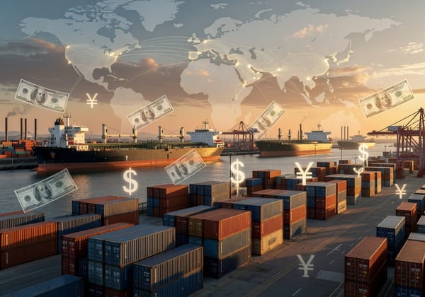
Britain's island geography is the textbook example. Surrounded by water and blessed with natural harbours, it developed the naval capacity that made it the dominant global power for two centuries. Britain's strategy was never just about ships, though — it was about controlling maritime choke points, the narrow straits and canals where global shipping is forced to converge.
Those choke points remain among the most strategically important places on earth. The Strait of Hormuz, just 30 miles wide at its narrowest, carries roughly one-fifth of global oil consumption. The Suez Canal handled about 12% of global seaborne trade by cargo value in recent years — until Houthi attacks in the Red Sea disrupted transit, causing ship passages to fall by nearly 50% in 2024 and forcing vessels onto the far longer route around Africa's Cape of Good Hope. Researchers estimate that disruptions at major maritime choke points cost the global economy around $10.7 billion per year in delays, rerouting, and insurance premiums, with an additional $3.4 billion in increased freight costs.
The Taiwan Strait is another flashpoint where geography concentrates risk. Much of the world's advanced semiconductor manufacturing sits on the island of Taiwan, and any disruption to shipping through the strait would send shockwaves through global technology supply chains.
Plains and Steppes: Abundance Without Cover
Flat, open terrain is a double-edged gift. It supports agriculture and population growth, but it offers no natural defences. Nations built on plains have historically been both wealthy and vulnerable.
The Eurasian Steppe — the vast grassland corridor stretching from Hungary to Mongolia — produced some of history's most devastating military forces. The Mongols, Huns, and Scythians all exploited the open terrain for rapid cavalry movement. Genghis Khan's empire, the largest contiguous land empire in history, was a product of steppe geography as much as military genius.
Russia's strategic outlook has been shaped by the same openness. With no significant natural barriers between Moscow and Western Europe, Russia has been invaded repeatedly — by the Mongols, by Napoleon, by Nazi Germany. This geography explains Russia's persistent drive to establish buffer zones and satellite states, a pattern that continues to shape its foreign policy today.
Poland, situated on the North European Plain between Germany and Russia, has been partitioned, invaded, and occupied precisely because its geography offers attackers easy corridors of advance. Understanding this helps explain why Polish foreign policy remains firmly anchored in NATO and the European Union — alliances substitute for the natural defences geography didn't provide.
Deserts: Barriers That Double as Shields
Deserts are geography's most effective isolation mechanism. They're harder to cross than mountains (you can't drink rocks, but at least mountains have streams), and they create vast empty spaces that separate civilisations from each other.
The Sahara effectively split the African continent into two distinct cultural and political spheres for most of history. Kingdoms south of the Sahara — Mali, Songhai, Great Zimbabwe — developed largely independently from Mediterranean civilisations, with the trans-Saharan trade routes providing the only thread of connection.
The Arabian Desert incubated early Islamic civilisation, and the camel-mounted armies that emerged from it turned the desert from an obstacle into a strategic highway. Armies that couldn't operate in arid conditions were at a severe disadvantage against forces adapted to them.
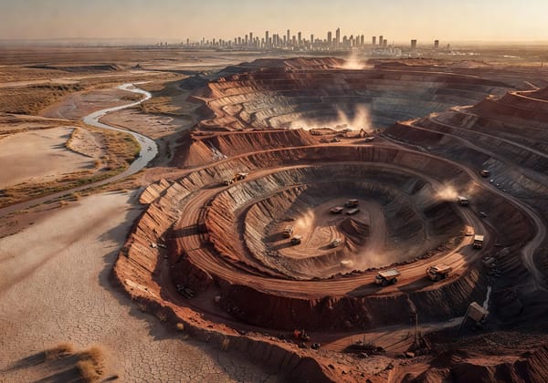
Today, deserts matter for a different reason: resources. The oil-rich deserts of the Middle East have made the region the most strategically contested on the planet. The Sahara, meanwhile, is emerging as a potential site for massive solar energy installations, which could reshape North Africa's geopolitical significance in the decades ahead.
Why Geography Still Matters in the 21st Century
It's tempting to assume that technology has made geography irrelevant. Satellites, drones, intercontinental missiles, and digital communication seem to erase the constraints of terrain. But the evidence says otherwise.
Russia's annexation of Crimea in 2014 was fundamentally about geography — specifically, securing access to the warm-water port of Sevastopol, which provides year-round naval access to the Black Sea and, through it, the Mediterranean. This is a strategic imperative that Russian rulers have pursued since Catherine the Great.
China's Belt and Road Initiative, which has attracted cumulative engagement of $1.39 trillion across roughly 150 participating countries, is essentially an attempt to overcome China's geographic constraints. Its western interior is landlocked and underdeveloped; the BRI aims to build overland trade corridors to Europe and maritime infrastructure across South and Southeast Asia. The China-Europe Railway Express now connects 128 Chinese cities to 229 European cities across 26 countries.
Meanwhile, climate change is literally redrawing the map. Melting Arctic ice is opening new shipping routes that could reshape global trade. In October 2025, a container ship departing China called at a British port after crossing the Arctic for the first time — a passage that cuts thousands of miles off the traditional route through the Suez Canal. Russia, China, South Korea, and the United States are all jockeying for influence over these emerging Arctic corridors, and the U.S., Canada, and Finland signed the Icebreaker Collaboration Effort (ICE) Pact in late 2024 to coordinate Arctic naval capabilities.
What This Means for You
Understanding the geography of power isn't just an academic exercise. It's a practical tool for making sense of a chaotic world.
When you see a conflict erupt, look at the map first. Ask what terrain features, trade routes, or resources are at stake. When a nation behaves in ways that seem aggressive or irrational, check whether geography explains the pattern — more often than not, it does.
Here are the key takeaways worth remembering. Mountains create natural borders and defensive advantages, but they can also trap nations in isolation. Rivers are the original engines of civilisation, and control of water resources is becoming one of the 21st century's defining geopolitical issues. Coastlines and choke points concentrate trade and strategic power — disruptions at narrow straits ripple across the global economy. Plains offer agricultural wealth but demand alliances or military strength to compensate for their lack of natural defence. And geography isn't static — climate change, new shipping routes, and energy transitions are actively reshaping which terrain features matter most.
The next time you read about a territorial dispute, a military build-up, or a major infrastructure project, pull up a topographic map. The answers are often right there in the contours of the land.